Rees Track, Cascade Saddle and Matukituki Valley
If I had to have a regret about our time in New Zealand, it could be that we did not spend more time in Mt Aspiring National Park.
Part of the Te Wahipounamu World Heritage Site which makes up most of the bottom left corner of New Zealand, the National Park is 355,543 hectares of remote beauty, attractive in part because of its inaccessibility. Situated between Wanaka in Otago and Haast on the West Coast, we by-passed it during the winter, and sort of chanced upon it again while staying in Queenstown in January. We were heading up to Glenorchy at the top of Lake Wakatipu to walk a section of the Routeburn Track, and thought we should find something else to do while we were there. We picked the Rees Track.
Rees Track
The Rees river valley is normally walked in combination with the neighbouring Dart valley, forming the Rees-Dart Track, or as the last section of the Cascade Saddle Route, which starts just west of Wanaka. The other end of the Cascade Saddle Route is 185km away by road, and when we walked it the Dart section of the track was closed following a land-slip, so decided just to start and finish at Muddy Creek car park at the foot of the Rees Valley, and see where we got to.
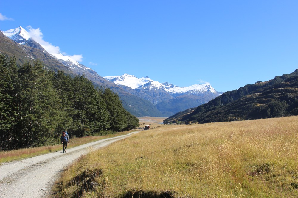
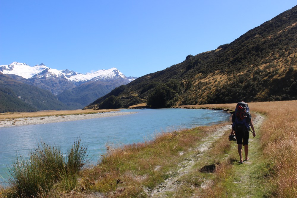
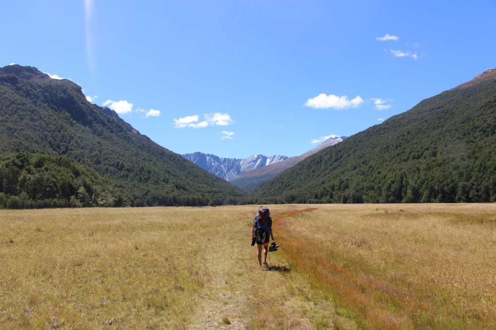
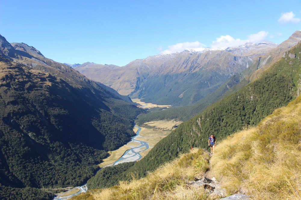
So we left Sam at Muddy Creek and started walking. To begin with the track passes through farm land along the wide, flat valley floor, heading towards the mountains. Within half an hour we had our boots off and trousers rolled up for the first river crossing. Shortly after that we realised the futility of trying to keep our boots dry, as the track frequently disappeared into vast expanses of boggy meadow and at times you could find yourself in up to your knees. During three hours’ walking along the valley floor, the scenery changed little (it was a straight, flat valley), but was always stunning.
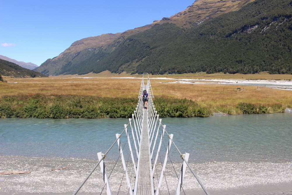
- Bridges are a rare commodity on the Rees Track
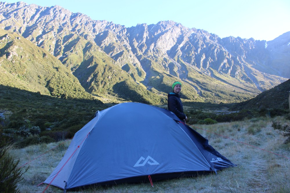
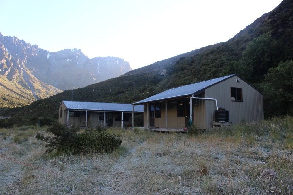
The track hits forest and rises steeply at the border of the National Park. We stopped for a quick lunch and started climbing. For the most part we were in forest, but at times the track opened out onto meadows, all the time following the Rees River upstream. At last we arrived at Shelter Rock Hut, where we decided to spend the night (camping outside, of course, because we are cheap!).
During the evening we chatted with a Belgian couple whose last big trek had been to Everest Base Camp, and whose journey to Asia had been via the Trans-Mongolian Railway. Their blog has given us some ideas for the way home…
Notre tour de l’OcéAsie
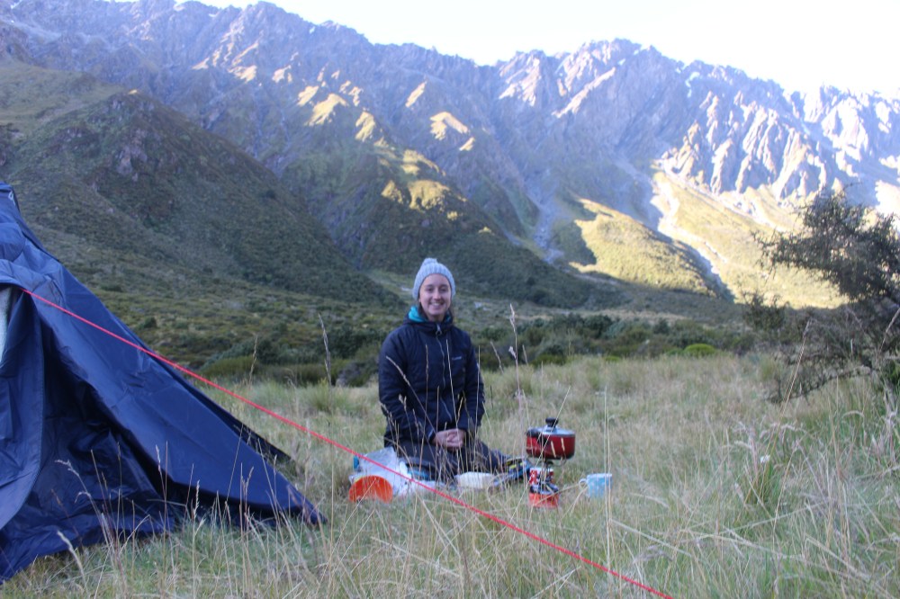
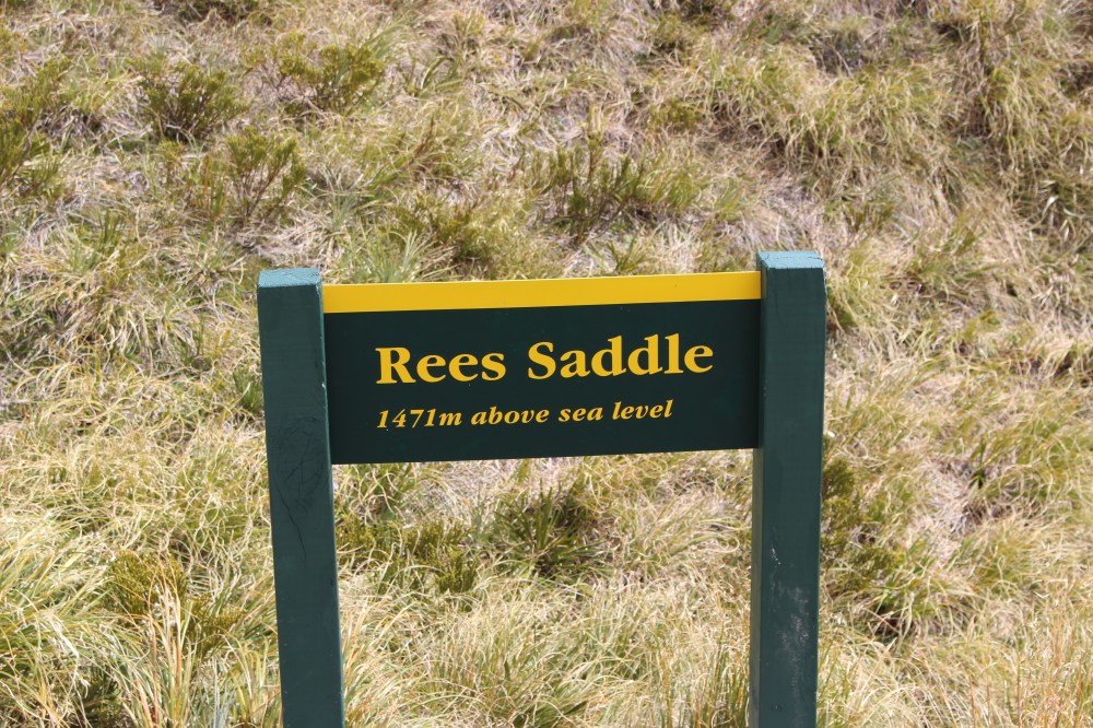
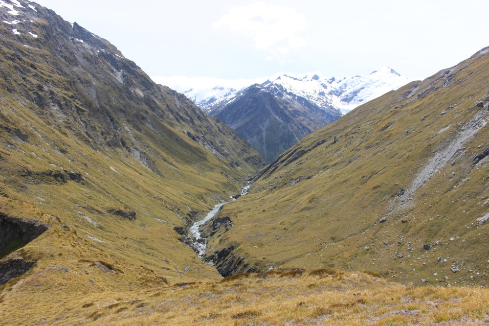
We spent a very cold night in the tent and woke up with frost on the flysheet, but we were able to light a fire in the hut and thaw out before we started walking. We had hoped to make it to Cascade Saddle, and then walk back out the way we had come. Having checked the weather forecast and seen that we would have faced gale-force winds, we decided to do a day walk from Shelter Rock Hut up to the Rees Saddle, spend another night at the Hut and then walk back out the next day.
We set off around 11am, our boots warm, if not dry, and climbed up to the Rees Saddle for lunch. At the top we met four friends, all in their sixties – two Australians, a Canadian and a Scot, all living in Australia – who were getting warmed-up for a nine-day hike the following week. We also met a large group of young Israelis, who had met at the Aspiring Hut on the other side of Cascade Saddle two days before. For reasons we never got to the bottom of, this particular route is very popular with young Israelis: we met 20-odd during our time in Mt Aspiring National Park, and have so-far met none anywhere else in New Zealand.
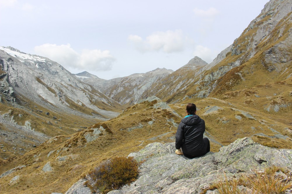
The view from the Rees Saddle was extraordinary, and we spent an hour or so at the top before retracing our steps back to the Shelter Rock Hut.
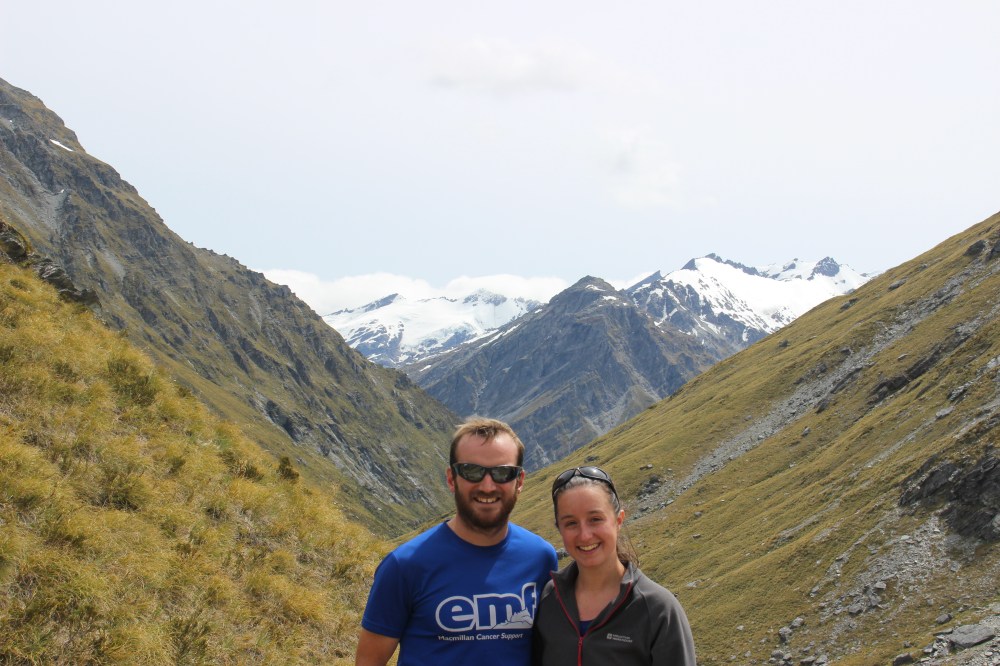
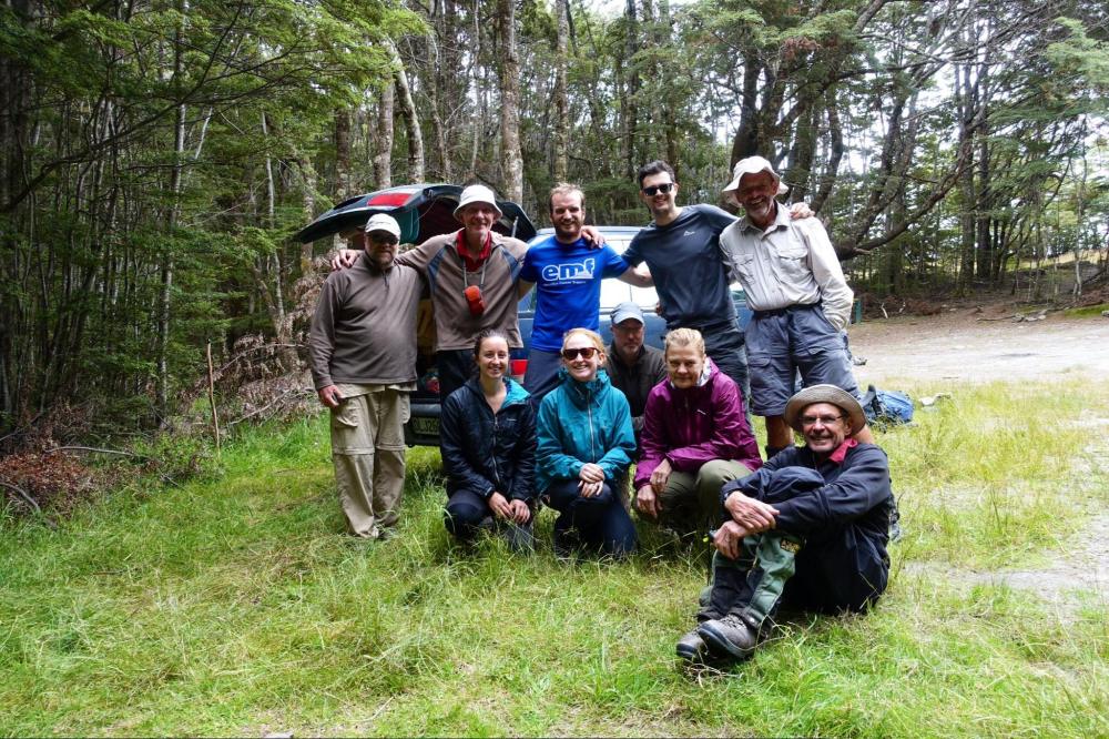
Back at Shelter Rock we decided to fork out the $15 per person per night for the hut rather than $5 to camp outside, having been very cold the night before (although there was no one there to accept our ‘back-country hut passes’, and when we tried to pay in the DOC office later we were thanked for our honesty and told to keep them!). The fire was roaring in the Hut at it was soon too warm and very busy, but we spent a pleasant evening talking to the four ‘Australians’ and new friends Jamie and Shona, more Scots living in Australia.
We were up early hoping to make good progress back towards the car-park before the promised rain set in, and walked with Jamie and Shona back down the valley, this time accepting wet feet as unavoidable and marching boldly through bogs and rivers where before we had tried to pick our way through.
Back at the car-park we were able to share a beer with our fellow trampers as they waited for various shuttles, before driving back to Glenorchy and a much-needed shower.
Cascade Saddle
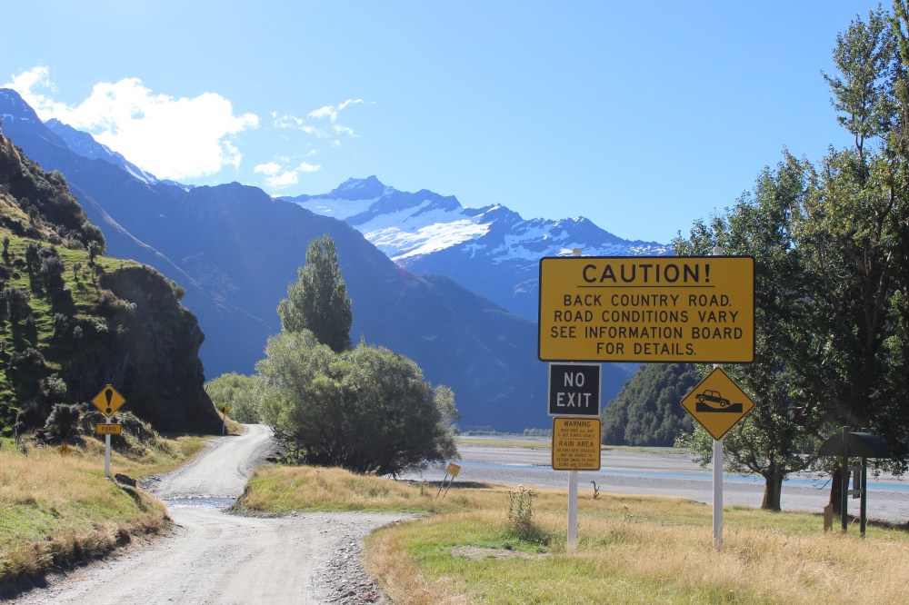
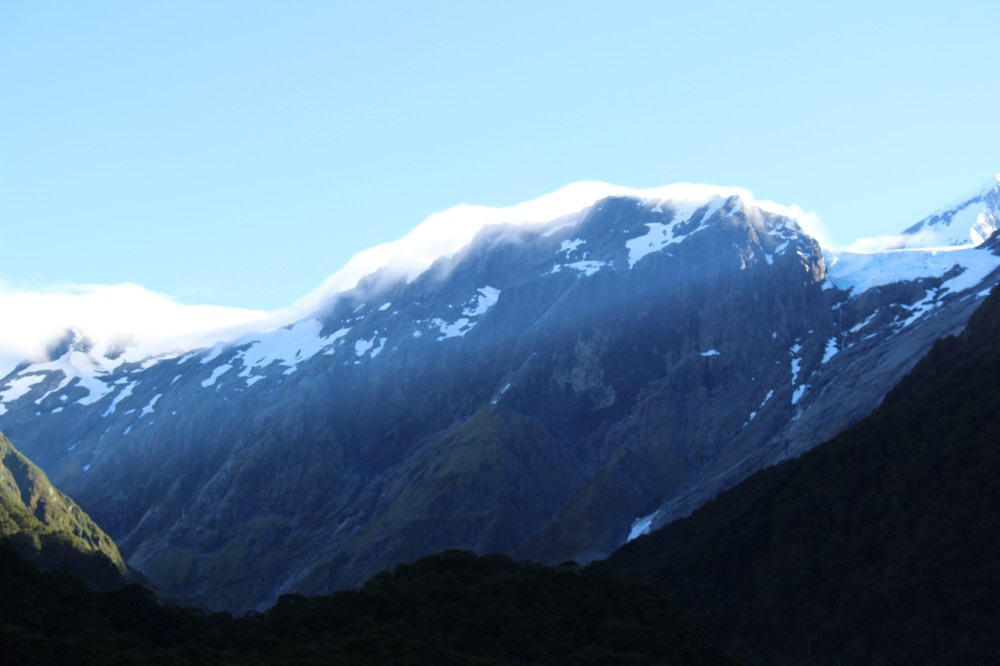
A couple of weeks later we were in Wanaka and able to do the other side of the Cascade Saddle route. Leaving Wanaka at 4pm (having sat out the rain in some of the town’s excellent cafes), the 50km drive west to the Raspberry Creek car-park took us nearly an hour and a half, with the 30kms of gravel road some of the worst we have seen in New Zealand, and the nine fords doing nothing to speed our progress. As usual, however, the views made up for it.
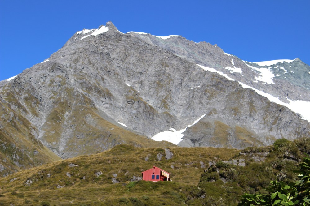
We set off from Raspberry Creek in the Matukituki Valley around 6pm for the two hour walk through farm land up to the Aspiring Hut (camping again – the hut is owned by the NZ Alpine Club and managed by DOC, pushing the price up to $30 per head; camping still $5). 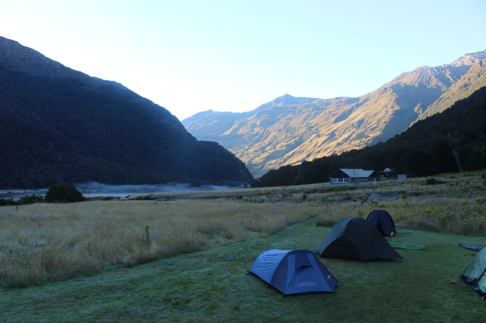
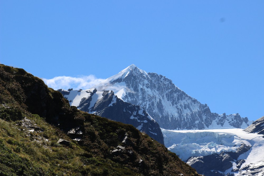
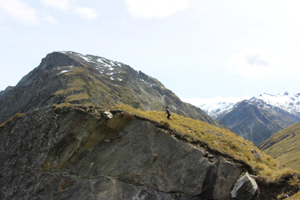
The next day we climbed up to the Cascade Saddle. This involved a steep scramble through the bush, followed by a steep scramble out of the bush, up to the pylon on the ridge (1835m) – around 1400m of climbing. After leaving the bush line behind, however, there are always views down the valley as far as the car park, and up as far as Mt Aspiring.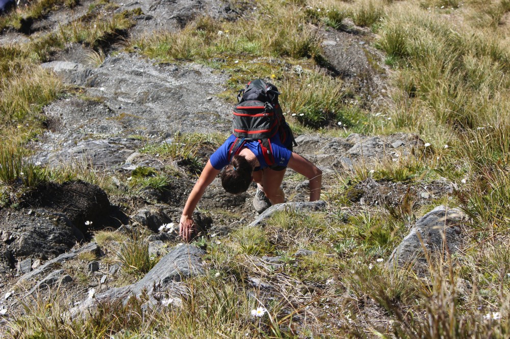
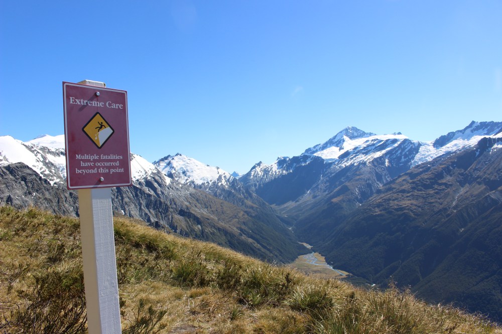
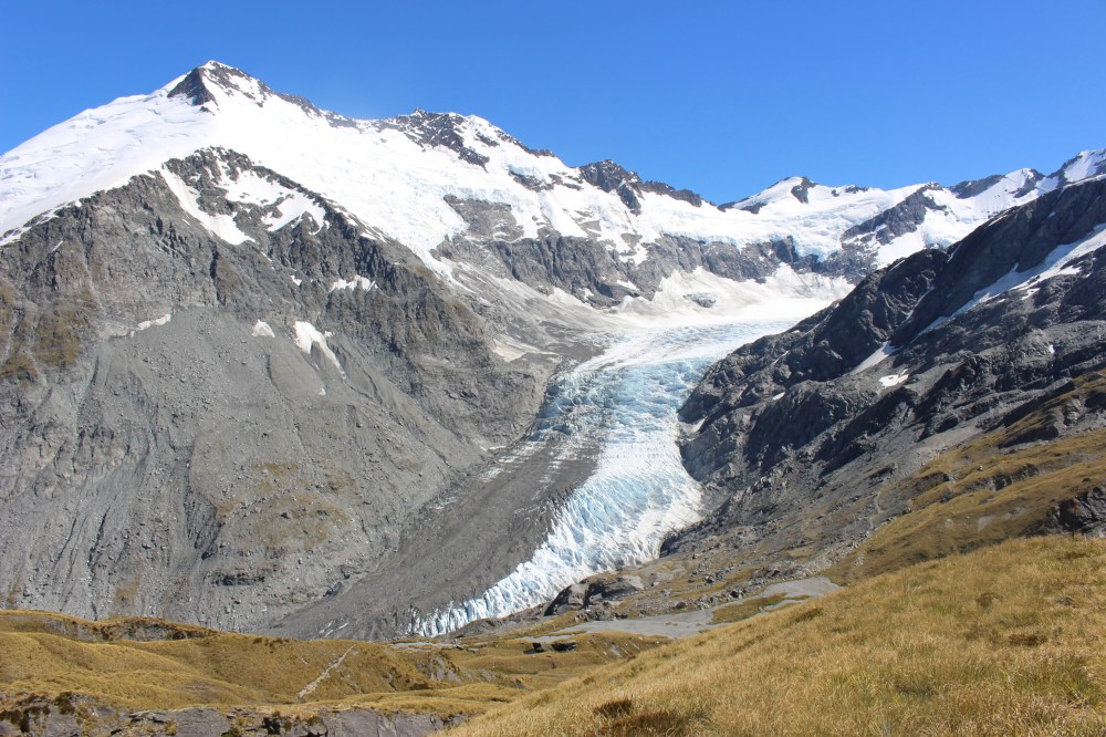
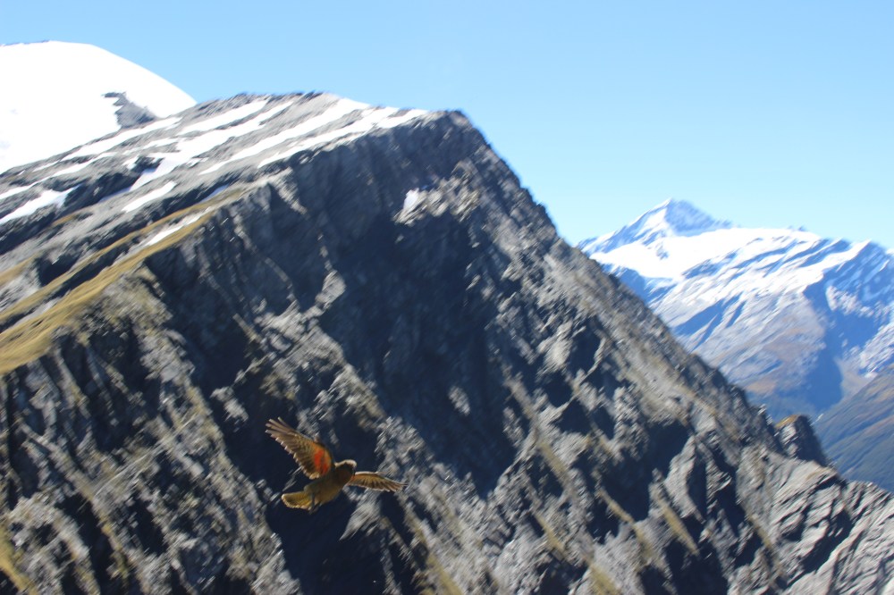
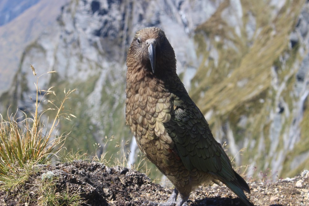
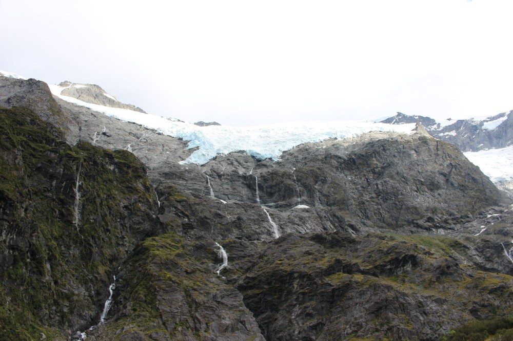
From the pylon the route drops down to Cascade Creek, across it, and then along flats and meadows to Cascade Saddle, at 1524m. We sat and had our lunch at the Saddle, admiring the view of the Dart Glacier, being careful not to lean too far back, and all the while watching out for New Zealand’s cheeky alpine parrot, the kea – we saw one pinch a whole packet of wraps from some fellow diners.
After lunch we retraced our steps and found out why DOC strongly recommends a one-way trip from Aspiring Hut, over the saddle to Dart Hut, and out via the Rees Valley: it was much harder on the way down, and we were glad to be carrying only small daysacks. In total the walk took us just short of nine hours and we had pretty tired legs when we got back to our tent. We had a very quick wash in a very cold stream, dinner, and the couple of beers that I had managed to squeeze into my bag.
Liverpool Hut
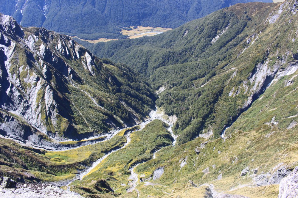
The next morning we set off early to walk further up the Matukituki Valley, through forest and along the lush green valley floor, with many a waterfall on either side of us.
 As we started up the steep track to the small 10-berth Liverpool Hut we started passing people walking the other way – apparently 22 people had squeezed in for a cosy night on the hillside. The climb took us an hour and a half, pulling ourselves up by tree-roots, rocks and anything else we could find, and we were again glad not to be carrying our full rucksacks.
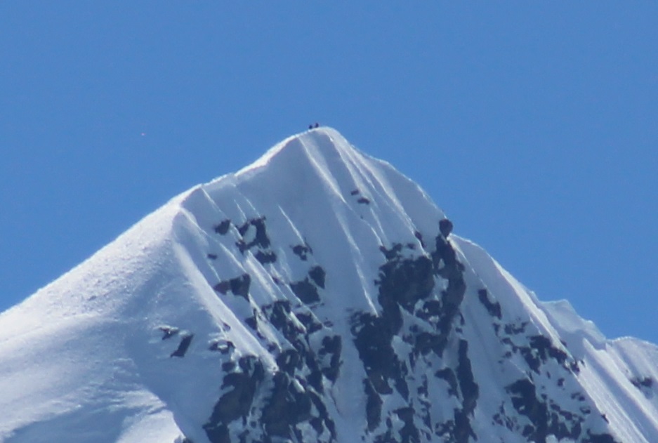
Once again our efforts were more than justified by the view, and another pleasant picnic spot. Another walker arrived and got his binoculars out just in time to watch a pair of climbers reach the summit of Mt Aspiring (3033m) at the top of the valley.
We spent about and hour and a half at the Liverpool Hut soaking in the views before retracing our steps back to the Aspiring Hut campsite. There we collapsed the tent and packed our bags, had a cup of soup, and walked the two hours back to the Raspberry Creek car park where we (possibly illegally) spent the night in Sam.
The next morning we did a short walk to have a look at the Rob Roy Glacier, just inside the park boundary, before braving the road back to Wanaka.
Now resting our legs ahead of the Motatapu Marathon, and then working for a month so we can afford to get home, we will probably not have time to explore much more of Mt Aspiring National Park – but there’s always next time.
Cascade Saddle Route – the two road-ends are 185km apart, but there are various shuttle services offered both from Queenstown/Glenorchy and Wanaka. The DOC visitor centres in Wanaka and Queenstown have more information. Alternatively many hitch-hike to and from the ends of the track, or hope to swap car keys with someone going in the opposite direction.
